Engage
- Ask students what they think the differences are between weather and climate.
- Provide students with one month’s local weather data by giving them copies of the monthly calendar you printed out, directing them to the Weather Underground Historical Weather page for your area, or having them collect temperature and precipitation data for your area (see Getting Ready).
- Using the Weather vs. Climate student page, guide students to examine the actual weather and compare it with the average weather by counting the number of days of the month when it was colder or warmer than average and the number of days when it was wetter or drier.
- Discuss student findings and climate in general, posing such questions as:
-
- Was this month generally warmer, cooler, wetter, or drier than the average weather?
- What is climate?
- What makes one climate different from another?
- How would you describe the climate where you live?
- How does climate affect people’s lives? How does it affect other living things?
Explore
- Show students the Annual Average Temperatures Map teacher page. Point out the equator and tropics on the map, and ask them for their observations about the map:
-
- What patterns do you notice?
- As you move away from the equator, what changes are apparent?
- What might cause these changes?
- Divide the class into pairs or small groups. Give each group a copy of the Global Ecozones Map student page and explain that this map shows different forest ecological zones throughout the world. As with the previous map, ask students what patterns they notice. Explain that the FAO system of forest classification uses temperature as the first criterion for classifying forests into different domains. It then uses precipitation and elevation to further classify forests into the 20 ecozones shown on the map.
- Give each group a copy of the Ecozones Defined student page, and point out that it shows the types of forests found in different areas, depending on the temperature and precipitation levels. It also shows forests at high elevations or mountain regions.
- Invite students to take a journey across the globe to explore different types of forests, giving each group a copy of the Extreme Journeys student page. Have students answer the questions on the student page using information from the maps and Ecozones Defined student page. If students have trouble differentiating some of the colors on the map, suggest that they consider which ecozone would make the most sense in a particular area given what they know about the five domains.
Explain
- After the students have completed their “journeys,” ask groups to share at least one thing they discovered through their group’s journey. Discuss these questions:
-
- What patterns did you observe as you went from place to place on the map?
- What climate factors influence the type of forest in an area? (Precipitation, temperature, latitude, and elevation.)
- What patterns did you notice related to temperature? To precipitation? To elevation?
Elaborate
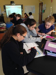
- Assign groups one of the forest ecozones to explore, and either provide the Forests on the Ground student page or have them conduct their own research on the assigned ecozone (see Getting Ready). Give them copies of the Forests and Climate student pages to guide their exploration. Point out that they will focus on Part 1 in this activity, and will complete Part 2 as part of Activity 5: Are You a Big Foot?
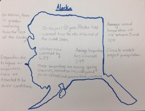
- Invite groups to create posters, maps, or other visual representations summarizing their assigned forest ecozone to share with the class.


